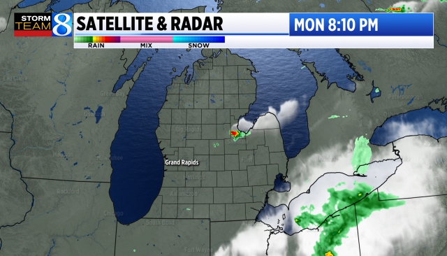
Severe thunderstorms pushed through northern Illinois and southern Michigan Wednesday evening, producing 14 tornadoes, isolated wind damage and heavy rainfall. (top pic. is a tornado near Elgin IL, with a rainbow – from WGN).

Ovid (near Lansing) had the most rain with 4.69″. I had 2.3″ of rain at my house in southern Alpine Township. Other rainfall totals: Grandville 3.30″, Lansing had 3.01″, East Gr. Rapids 2.72″, Grand Ledge 3.95″, Freeport 2.16″, Jamestown 2.10″, Grand Rapids 1.68″, Holland (airport) 1.38″, Muskegon 1.31″, Kalamazoo 0.91″, Battle Creek 0.78″ and Jackson 0.21″. Also: Hudsonville 3.01″, Grandville 3.30″, south of Caledonia 3.37″, Alaska 2.76″, Cutlerville 2.64″, Bradley 2.50″, Wayland 2.39″, Walker 2.33″, Allendale 2.27″, Hastings 2.16″, Lowell 1.92″, Kent City 1.68″, Fennville 1.53″, Belding 1.47″, Sparta 1.28″, South Haven 1.13″, Fremont 1.01″, Hart 0.66″, Marshall 0.48″. Here’s a complete list of rainfall totals.
Buck Creek in Grandville crested at 8.6 feet – that’s above bankfull, but below the flood state of 9 feet. The Grand River at Ionia crested around 15.5 feet – again above bankfull, but still well below flood stage. The Ionia Free Fair is the third week of July. The river didn’t cause any significant flooding at the fairgrounds.
The totals for both Lansing and Grand Rapids were record rainfalls for July 12th.
The Storm Prediction Center lists 129 reports of severe weather on Wednesday. That included 15 tornadoes, 13 in northeast Illinois, 1 in Michigan and 1 in Iowa. There was also some damage near Lawrence in Van Buren Co. Also, there was a waterspout over Lake Michigan:
0900 PM     WATERSPOUT       2 NW SAINT JOSEPH       42.12N 86.53W
07/12/2023                   LMZ043             MI   PUBLIC

            MULTIPLE REPORTS ON TWITTER AND FACEBOOK OF
            A WATERSPOUT OFFSHORE OF SAINT JOSEPH,
            MICHIGAN. PHOTOS AND VIDEOS CONFIRM
            WATERSPOUT REMAINED OVER THE WATER AND DID
            NOT COME ASHORE. TIME ESTIMATED VIA RADAR.

Had this waterspout not dissipated, it would have come onshore north of St. Joseph near the Berrien/Van Buren County line.
There were 107 reports of wind damage and 8 severe hail reports. The hail reports were all in KS, NE and MO. Minatare NE had 2″ diameter hail.
In Michigan, there was wind damage southeast of South Haven near Lacota. Winds hit 63 mph in Lansing, 57 mph at Lake Odessa and 46 mph at Three Rivers. Middleville had a gust to 43 mph. There was isolated wind damage from Barry County east into the Lansing and Flint areas. That included Hastings, Irving, Yankee Springs, Belding and Ionia.


Look at the chair up in the tree in the picture above.


Tornadoes were spotted at both O’Hare Airport (some warehouses were damaged on the west side of the airport) and at Midway Airport (to the northwest). Both airports initiated ground stops.

Southwest radar – Some welcome showers and thunderstorms over SE Arizona into N Mexico. The Southwest has been very hot and should be even hotter during the next week, but IMO some media outlets have been a touch overboard on the heat. Tuesday, Phoenix AZ had a high temperature of 111° on Tuesday. That’s hot, but only 4 degrees higher than average and well below the record high temperature for 7/11 of 118°. Phoenix was 2 degrees cooler than average during the month of June.

Northeast U.S. radar – a day to dry out after record rainfall in parts of New England. Montpelier VT had another 1.11″ of rain on Tuesday. They’ve had 8.17″ of rain this month and that’s 6.69″ above average.

ALSO: Large hail can be deadly for birds. With the extra heavy snow in the mountains, well above average rainfall and standing water, parts of California are seeing well above average numbers of mosquitoes.


