Hike of the Month: Eruption Trail at Mount St. Helens
Mount St. Helens is a neat, crisp gray-and-white view from high points in Portland, but when you're close up on its north side things are a little different.
Image: Margaret Seiler
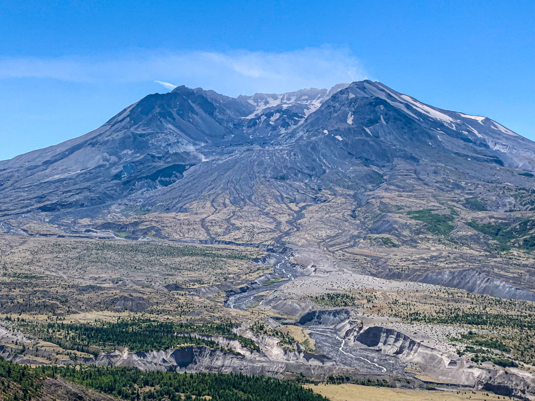
Portlanders are used to seeing Mount St. Helens from the south, as a neat triangle with its tip snipped off, a trapezoidal tabletop. But a two-hour drive, first up I-5 and then out the Spirit Lake Highway, brings us to the northern view, and things get a little messier. Imagine a utilitarian, flat-bottomed bowl at a DIY ice cream sundae bar, filled by a child who loves chocolate sauce, sprinkles, and all manner of toppings, but the bowl had been turned upside-down, tossed on the floor, and stomped on, so part of its flat bottom (now the top) is caved in.
That’s the view that greets visitors to the Johnston Ridge Observatory, part of the Mount St. Helens National Volcanic Monument and usually open until mid-October, when weather and winter conditions will close the road. Early fall is the last chance to catch this view with just an easy drive and, for now, a free place to park—though that’s something that could change in 2023 if some US Forest Service proposed changes are approved.
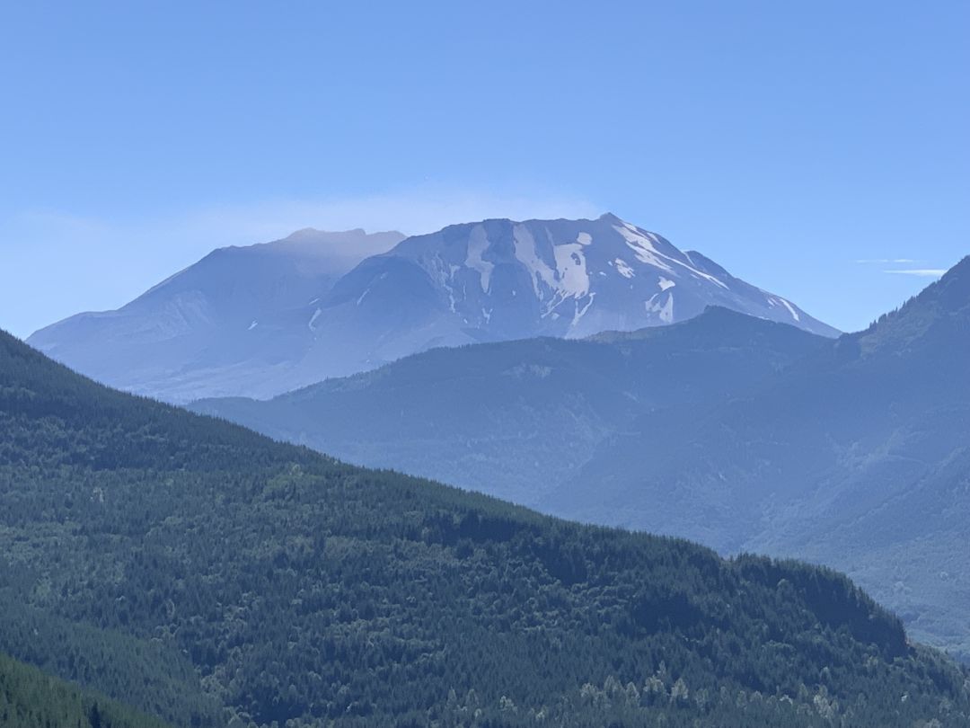
Drivers will want to pull over along the Spirit Lake Highway when Mount St. Helens starts coming into view.
Image: Margaret Seiler
Portlanders can get their first glimpses of the toppled sundae from WA-504 (a.k.a. the Spirit Lake Highway) about 25 miles after they leave I-5 at Castle Rock. There are several viewpoint turnoffs along the road, all worth a stop to take in the view as St. Helens grows nearer. For a picnic-and-bathroom break en route, hit the Forest Learning Center, where you can also take in some Weyerhaeuser propaganda (“We harvest less than you think,” declares one logging exhibit) and load up on Bigfoot merch in the gift shop. (According to the greeter, there’s “a guy in the back that knows everything—everything.” We presume this refers to the events of the 1980 eruption, but we can’t guarantee it’s not a Bran situation from Game of Thrones.)
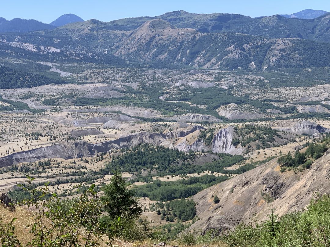
A view of some of the changed landscape below Mount St. Helens's peak
Image: Margaret Seiler
Once you get to the end of the road at Johnston Ridge Observatory, take a minute to look around the parking lot and remember how close we are to a major world destination. There are aged passengers from American Cruise Lines buses, teenagers from the East Coast in flip-flops, young families traveling from Europe or Asia. There are also plenty of locals, from fancy-backpack-and-poles hikers who never let their REI dividend go unspent to elementary schoolers in “Gods, Guns, Trump” T-shirts climbing out of minivans with Washington plates to dog-leash clutchers who didn’t get the no-pets-allowed message and are stuck in the tiny bit of shade in the parking lot until another person in their group comes to take a turn holding the dog so they can go take in the view.
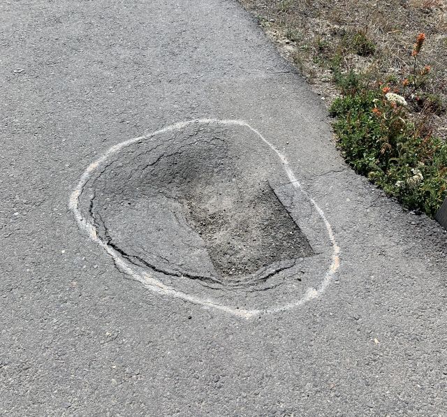
The short Eruption Trail is paved, but it can be steep, and it has a few craters of its own.
Image: Margaret Seiler
It’s just a short walk up to the observatory, and from there a half-mile paved path called the Eruption Trail can be traversed, camera in hand, to a soundtrack of clickety-clackety grasshoppers and people asking strangers to take a photo of them. Be careful not to stumble in the craters along the path (a drainage issue and not an intentional adherence to the theme, we hope) while you’re gawking at the crater and the altered landscape below it, a million shades of green and brown and dotted with hummocks, little mounds of what used to be the mountain’s innards.
The $8 admission fee (waived on National Public Lands Day and a handful of other fee-free days) to enter the observatory itself is mainly to cool off in the AC, ooo and aah at the tiny lights simulating the eruption and ensuing lava flows on a scale model, and watch the short movie (after which you may be tempted to declare “hummock” your new favorite word).
Next year, this day pass for anyone 16 or older could increase to $12, or the feds might instead institute a $30 vehicle fee to enter the national volcanic monument, good for seven days. The potential changes are part of a suite of proposed fee increases in federal public lands in the Pacific Northwest. Nearby, in the Gifford Pinchot National Forest, there are proposed campsite fee increases at Cultus Creek, Forlorn Lakes, and elsewhere. In the Mount Hood National Forest, there could be a new $5 fee to park at the Lolo Pass, Little Badger, and Badger Lake trailheads, and a new $10 site fee to camp at Little John or Polallie campgrounds along Highway 35, among other changes. Public comment is accepted through September 30 for Mount Hood locations, and through October 7 for Gifford Pinchot locations.
Before you set out, check Mount St. Helens National Volcanic Monument and the Gifford Pinchot National Forest’s social media for road condition, weather, and fire updates, not to mention eruption news or risk, or check out the beef-starting, human-hating, profanity- and sexual-innuendo-laden, highly unofficial @MtStHelensWa Twitter account for a good laugh. (Don't say we didn't warn you.)