
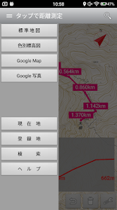
「距離測定」地図をタップで簡単
Contains ads
10K+
Downloads

Everyone
info


About this app
Safety starts with understanding how developers collect and share your data. Data privacy and security practices may vary based on your use, region, and age. The developer provided this information and may update it over time.

No data shared with third parties
Learn more about how developers declare sharing

This app may collect these data types
Location, App activity and 2 others

Data isn’t encrypted
Data can’t be deleted
What's new
Android13に対応しました。


